
A travel diary:
Will my grand-granddaughter find the God ?
She was so happy, happy in the most possible way.
She was exclaiming, I found the God. I am so lucky. I found the God.
I was perplexed to see her.
God ??
Yes…. Oh Yes, lord Vishnu, our supreme God.
Look at this. She showed me a small stone with some pattern in it. She added: “These are the footprint of the God. If we keep it in our home and pray in it, there will be peace and prosperity in our family”.
For me, I was seeing a stone with a beautiful pattern in it, at her hand.
I don’t have anything to tell about the belief system, but as I saw the pattern on the stone, I was captivated, it was marvelous. These imprints on the stone were wondrous, and seems these reflects the geological time.
I started searching more about them.
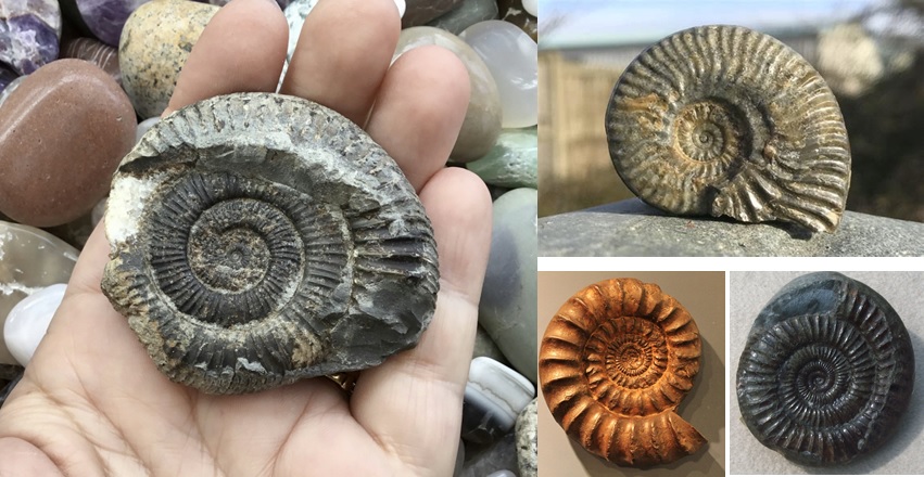 (an example of ammonite fossil, obtained from google image search
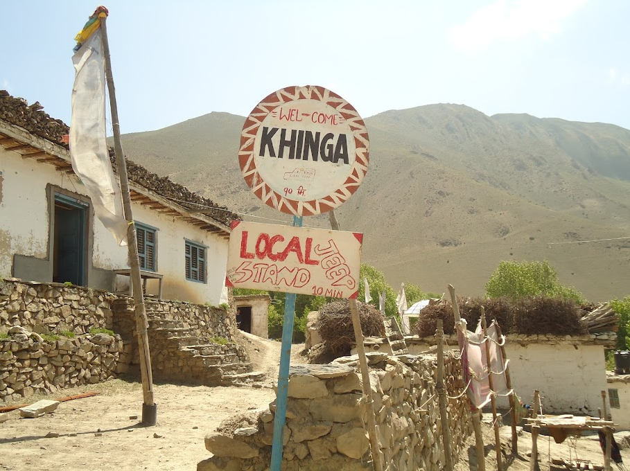
I was in Nepal, a land-locked country, situated in between India and China. It has an area of 147,181 sq km (56,827 square miles). I was on vacation with my family, on a religious trek, in the middle of the mountains.
The location is called Manang, and lies in the north leeward side of the two majestic mountains the Annapurna (8,091 m)( 26546 ft) and Dhaulagiri (8,172 m) (26811ft) ranges.
We hired a helicopter to take the flight from Kathmandu (capital of Nepal) to Muktinath (a religious temple of the area) situated near to the Kali-Gandagi river in Manang area.
We stayed in the Kagbeni Hotel.
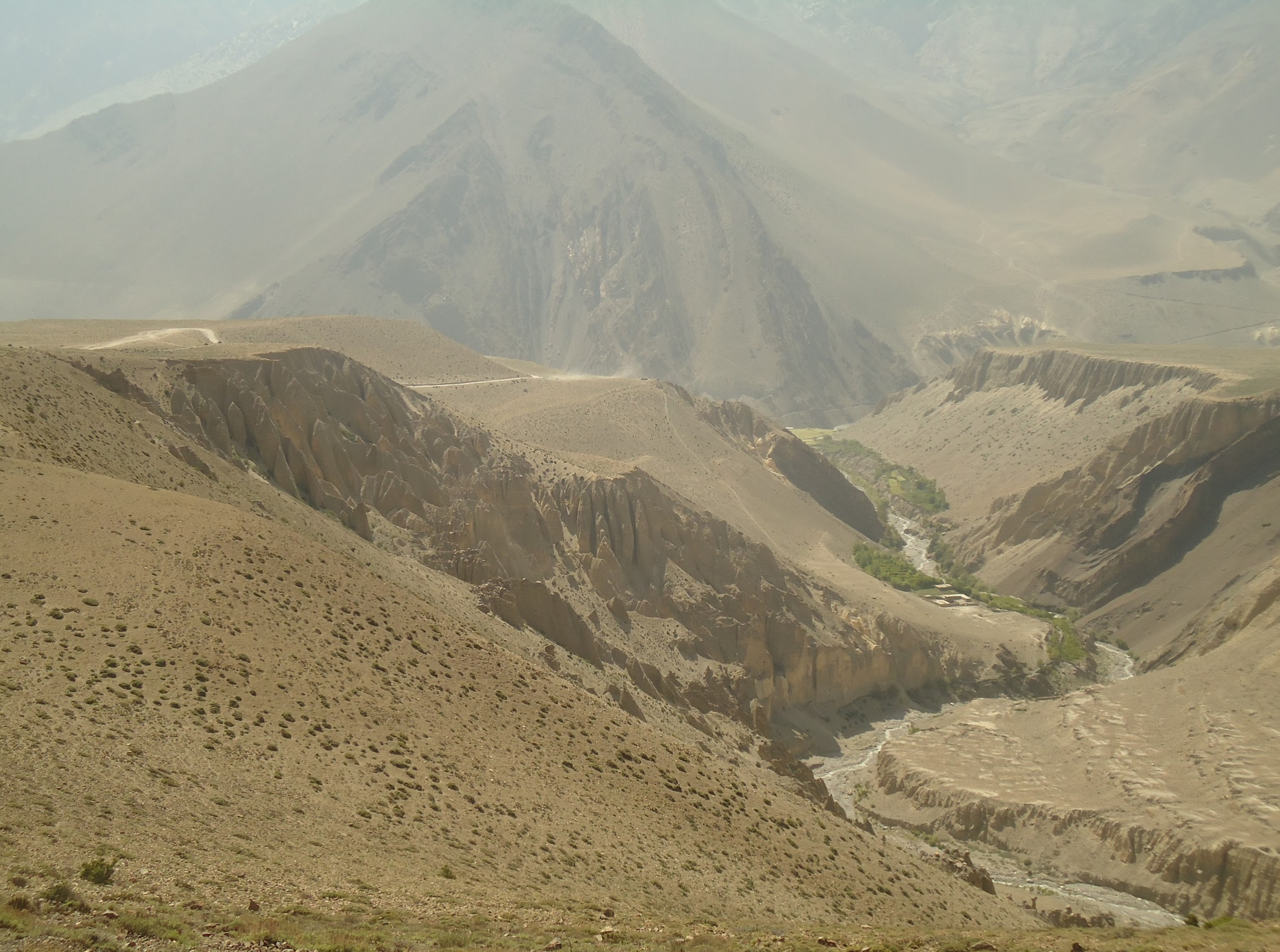
The landscape allured me, it didn’t have much vegetation. I was feeling as if I was walking in the conglomerate of sand and gravel – systematically and beautifully arranged. It felt as if I was a small ant walking in the gigantic recently made structure.
At first, I was perplexed to see this unique topography in the Himalayan region, and then the existance of the shells of extinct invertibrate within the Phylum Mollusca. According to Natural History Museum these species thrived in the Paleozoic and Mesozoic Eras, which equates to approximately 408 to 65 million years ago. These species have been useful in indicating the locations of ancient seas within the geologic record.
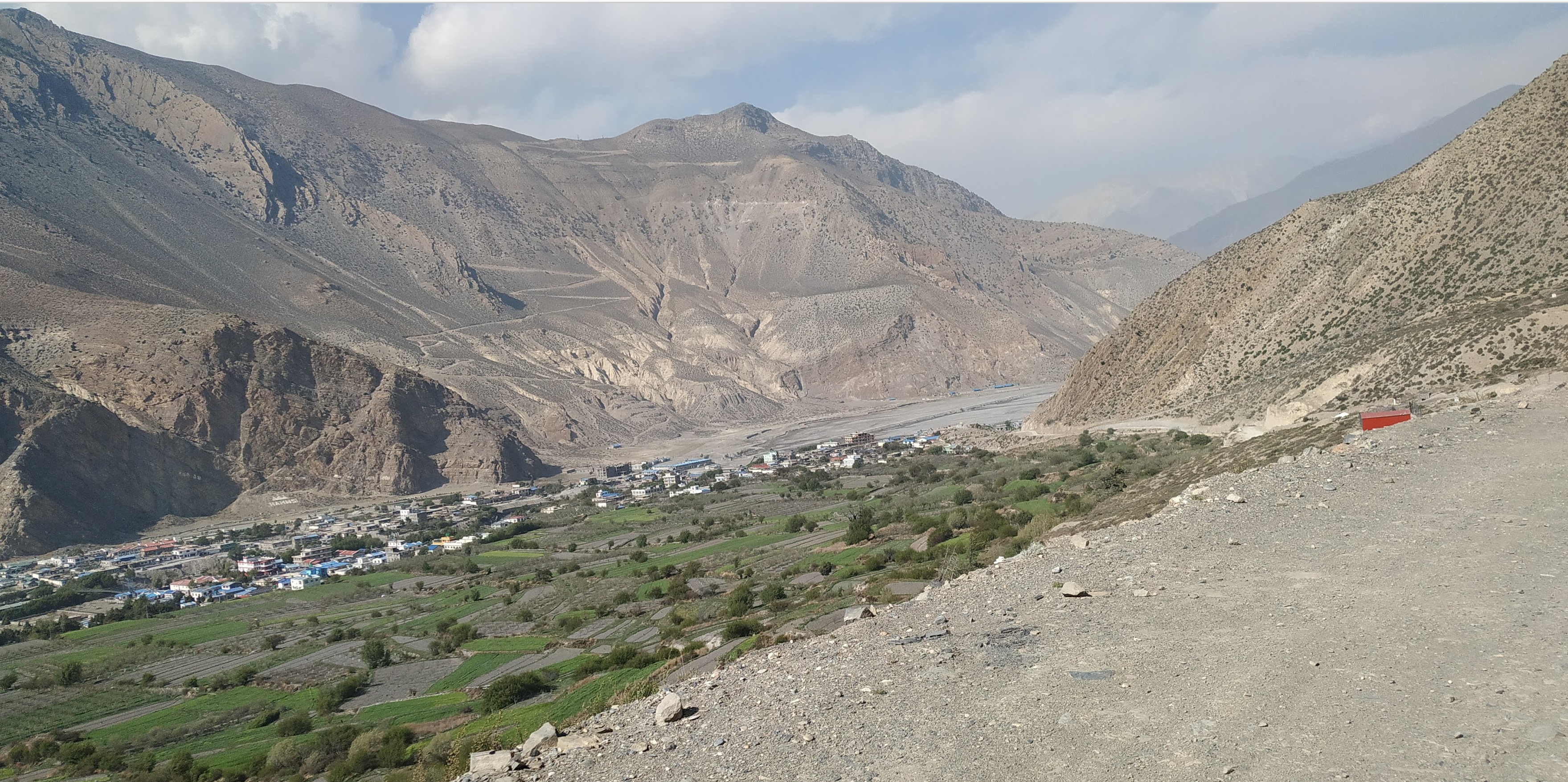 (Landscape of the area, photo from my archieve)
But the main question is…. How did the shell of the ocean species, that had been extinct, appearead in the landlocked country. It made me think about it…. Did the river bought it? The nearby Kali Gandaki river – originates from Himalaya!! So how did these awesome architecture were found in this region !!
What could have bought these objects, in the middle of the poor landlocked country. Had it been found in some of the rich countries, that place would have been marked as a natural heritage site, and well preserved. But in this location, these ammonites and other precious shells are sold in less than a dollar each day – in thousands of numbers.
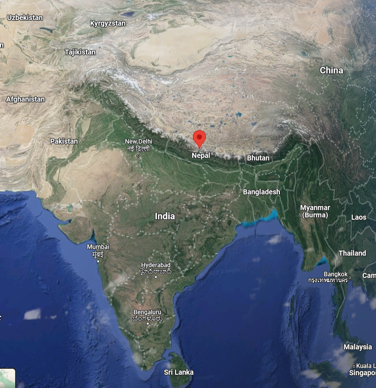 (Google map showing Manang area of Nepal)
On the way to the temple, I saw an old woman selling the ammonites.
Did you collect this?
No, I used to collect them while I was young, but now, I am old, my relatives collect it for me.
I asked.Where can I find them ?
Muktinath temple, is commonly known as the home of Vishnu, (mukti means Salvation, and nath means lord; therefore this temple is also known as the home of the lord of Salvation). The nearby Kali-Gandaki river is the place of God. Therfore, these God gifts are left around his home, but not far away.
She was pointing towards the river: Do you see that river ? if I walk half an hour I used to find nearly 10-20 of them; but now my children are telling me that they must go further to find them, and they don’t bring much. The influence of more tourists has decreased the availability of it.
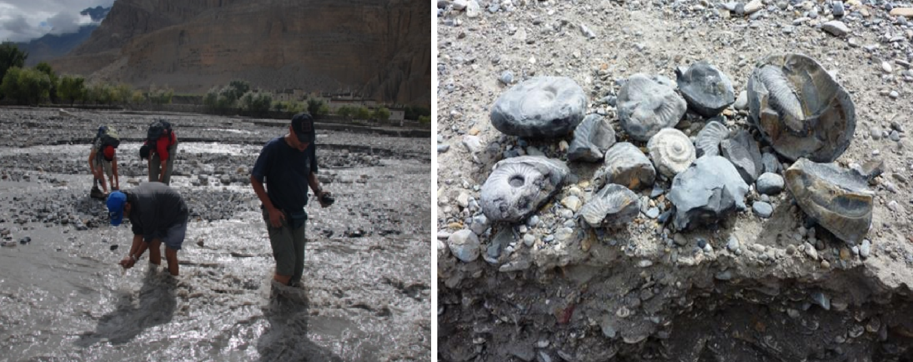 (People searching amonites in the river, photo from https://www.geocaching.com/geocache/GC1YF77_kali-gandaki-trek-9-river-of-ammonites )
Dhital, M. R. (2015) in his book ‘Geology of the Nepal Himalaya: regional perspective of the classic collided orogen’, shares that the Himalayan region is renowned for its pristine scenery, spectacular geological exposures with predominance of the ammonites. In the chapter: Introduction to Tethys Himalaya, he highlights the species of ammonites found and shares that there are 67 species around Jomsom, Mustang. The ammonites are also recorded from other parts of Nepal like Tinkar Lipu, Dolpa and Everest region.
The studies by Messerschmidt, D. A. (1983) these are found in the precipice and riverbed, where river has washed down the earth. The common genera found are: Prograyicears, Blanfordiceras and Paraboliceras. And they date to the early Oxfordian to Late Tothonian Age (165 to 140 million years ago) at the end of the Juarrasic Period.
 (Houses and the bus station, photo from archieve)
In the next day morning, she was so happy, and was showing the ammonites that she found on the river channel, at her hand. I don’t know how long she walked to find those ammonites, but she was happy that she found the God.
Before starting this travel, she was curious as well as a bit frightened due to the exotic location and the potential breathing problem due to her age. But today, she is really happy, because she was able to be on the temple, and now, she found the God. She got salvation.
She took the helicopter and flew back to Kathmandu at around 8 am in the morning. I had planned to walk to the nearest airport, Jomsom, observe the landscape and fly back by taking the regular flight.
The locals told me that it will take nearly four hours of downhill walk. I walked from Muktinath temple, to Jomsom. I thought it would be fun walking in the pristine landscape, but later the wind blew my mind. The wind was blowing, I could hardly walk properly, my walking speed reduced highly. The small pebbles that came along with the wind were hitting me all over my body. I thought my glasses were broken. I guess at that time, the wind speed was arond 43 m/s because in a study by Ghimire et al in 2011, states that the region has the wind speed in the area ranges from 3m/s to 45m/s with the wind power density of 173 kw/m2.
I was surprised to see the caves in the gigantic mountains, along the way. What could have created these artificial cave systems in Muktinath Valley, nearly 1000 m (3200 ft) above the current location of the community, in between the mountains? Did the people stay in those locations in the past? Did the erosion blow all this land? Are those the remains from the erosion ?
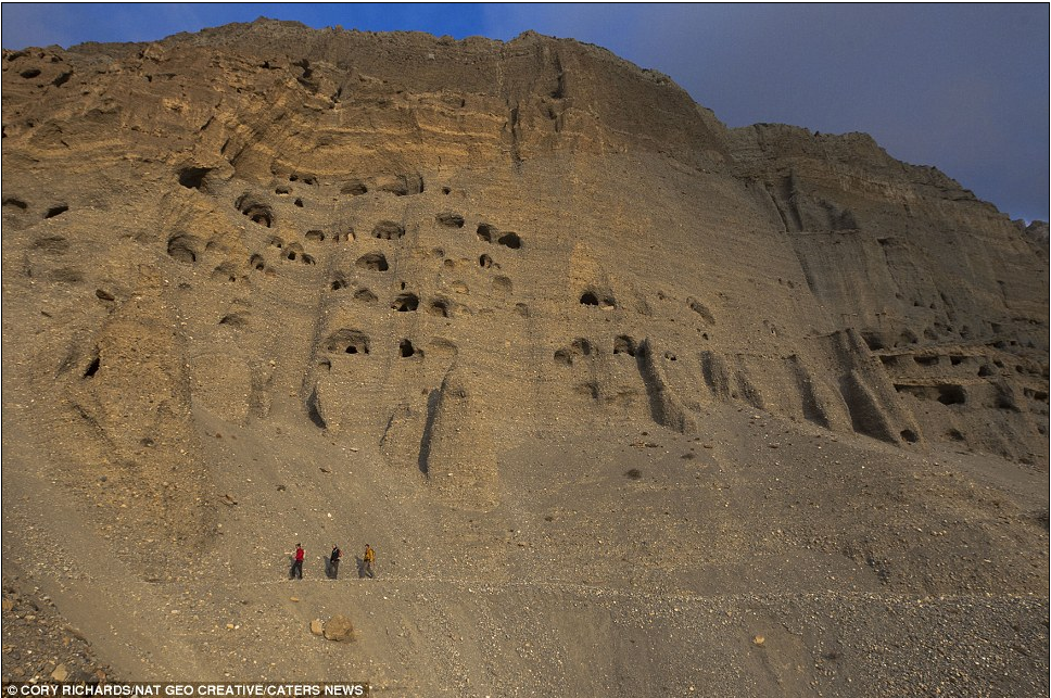 (photo reflecting the comparative height of a man, the mountain and the caves, from: https://www.dailymail.co.uk/news/article-2403094/Mystery-ancient-caves-Nepal.html)
My curiosity grows as I spend more time observing the landscape.
Simons, A. & Schön, W. in 1998 had studied these caves of the region, and found that these caves are interconnected complexes with several stories, connected by staircase and galleries. In some cases, these cave systems or terrace settlement could be as many as 14 stories, over hundred individual rooms. However, most of them had 12 to 40 chambers. The floor area was around 4-12 m2 and height is of only 1.2-1.6m. Based on 14C dating, it is assumed the initial settlement began around 1200 calBC and continued until the 5th century calBC.
Likewise, the archaeological study revels that that these caves were also used as the community burial chamber from ca. 400 BC to 50 AD. In the study, by Alt et al in 2003, showed that the individuals were well adapted to the extreme environment.
Does this mean that the ancient people created and stayed in those caves in an attempt to be safe from the extreme weather ?
Were these structures, their home ?
Is the current landscape formed due to the wind and river erosion in the area ?
Along with the wind, the erosive power of the water had played an important role in defining this landscape. In this region, most of the rainfall occures during the summer, and it is also the time when there is higher temperatures. The summer coincides with the melting of snow, and hence higher amount of water in the river, subsequently increasing the flow of water – meaning an enhanced the erosive power.
In the ariticle by Haffner, W., & Pohle, P. published in 1993, highlights that along with the sand and water erosion, there had been glacier lake outburst and flood, which has significantly changed the landscape of the region. A similar study by by Monique and Etienne during 2013, on the alluvial and debris from thise region, shows that the region has been significantly changed due to the avalanche, rock flood and sediment removal.
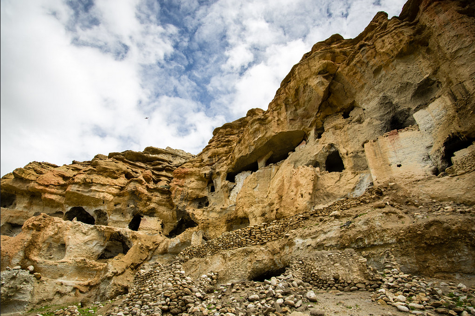 (Current status of caves, photo from: https://www.flickr.com/photos/simogogo/44442906064 )
My face was hurting, the small pebbles that came along with the wind were hitting my face, I finally reached a hotel in Jomsom.
I ate some food, and was getting ready for the flight, but the hotel owner came to my room, and told me that the flight has been cancelled, due to the bad weather. All the flights for today are cancelled. And they don’t know when the next flight will be, maybe tomorrow, may be not. The next regular flight, according to them is after three days. I didn’t know how to respond.
My phone was hardly giving any connection signal. I had to walk nearly an hour to get the strong tele-communication signal. I called my mother. She was not anxious that I was not returning but she was happy… I was in the pilgrimage place. I was never a religious person in her eye, so she was happy that I was staying in the lap of the God.
I was feeling what she was saying.
This place had interesting alluring capacity, therefore, many tourists not only from Nepal but also from other countires visits in this location. People from India come to this temple and take a dip in the holy water. They believe that it is one of the holy location, that they wish to visit, at least once in the lifetime, because it rejuvenates life.
I don’t know if poverty is bliss or a problem. I got a good night’s sleep. There was no heating system, no proper temperature, it was cold, and I was staying in a house made of rock and wood, without proper insulation. The sanitation was poor. But in spite of it, my stomach was good, I was feeling healthy.
Each day, I am getting new information and enthusiasm. I think, I can spend one week exploring and talking to the people. It was my second night in the area.
According to Messerschmidt, D. A., & Sharma, J. (1981) this Muktinath region has secular association with the concept of devotion, natural features like presence of quaternary fossils, and representation of the historical development of the landscape. I flet like I was observing the history and present scenario both at the same time. The co-existance of the anthropogenic and natural process.
I felt this place as the live museum of the geological and natural processes. If we closely observe, we can see the linkage between the deep time and the present time. Along with Haffner, W., & Pohle, P. (1993), I also believe that this place has been culturally and scientifically important.
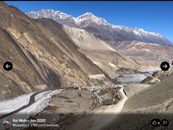
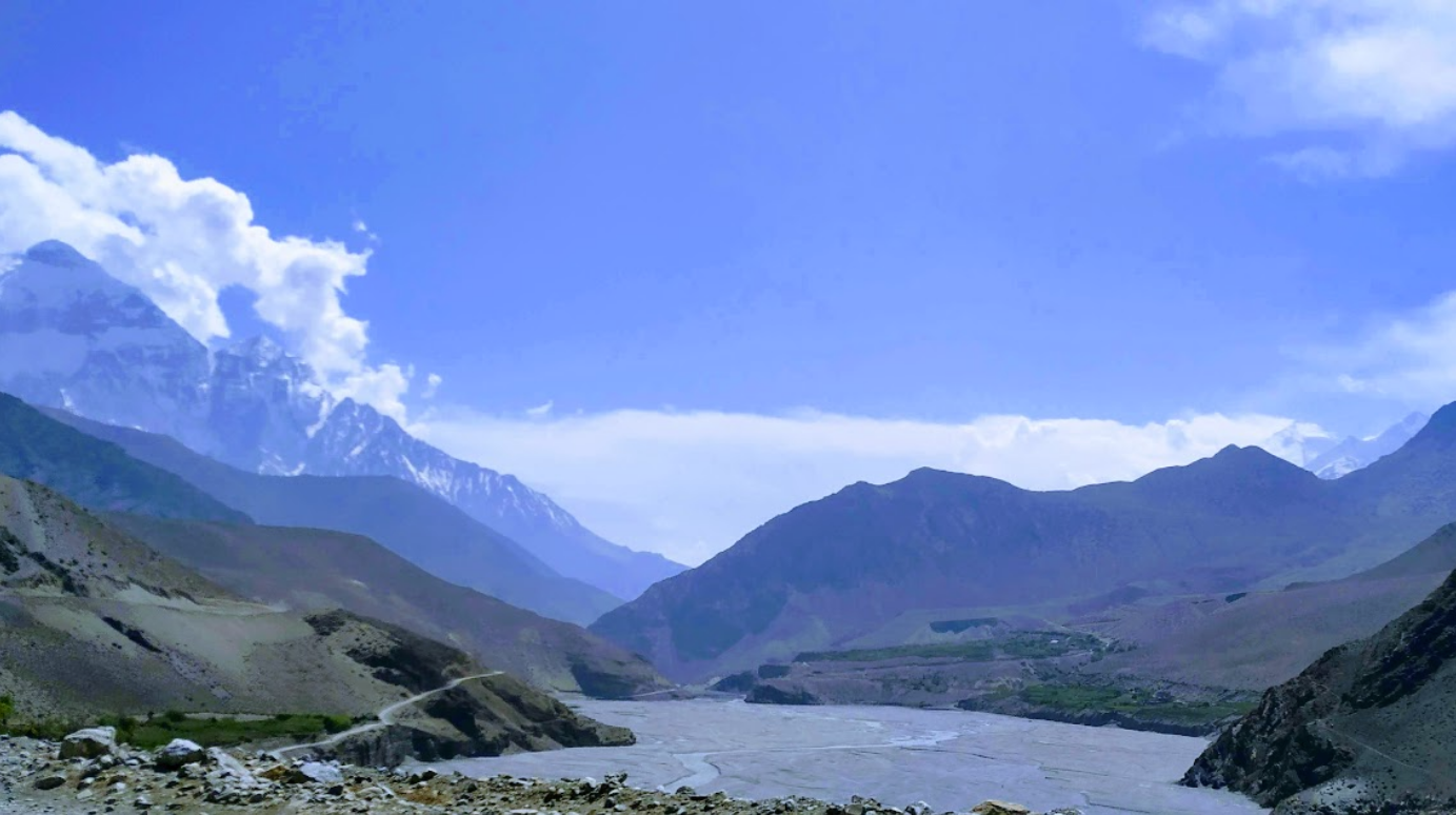
 (The view from the mid section of the mountaion to the lower section, photo from archieve)
On the early next day, I planned to go to one of the mountains to see if I could find something interesting. May be some unique feature of the natural process or may be another God.
Based on the sediment budgent and fluxes study by Fort, M., & Cossart, E. (2013) the authors reasonably assumes that the current location where there is thick debris flow deposit was the region of the Mt. Dhaulagiri glacial tongue, and it was ice-free during the last glacial maximum, while it might have been temporarily impounded by sediment export during the Holocene.
According to Blum, (2007) paper, quaternary glacial–interglacial cycles of climate change have had a profound impact on fluvial systems. Therefore, it is likely that during the glacial period, there might have been glacial advancement in the region. And the study by Duncan et al in 1998, based on the Digital Elevation Data and Satellite Imagery analysis shows that the glaciation had reached elevation of around than 2000 m in the Kali Gandagi drainage, which means it was in many parts of Manang. And presence of the glacial moraines (probably from last glacial maximum) in different parts of Manang also supports this hypotheiss.
Similarly, during the interglacial period, there might have been major glacier retreat, exposing and transporting the subsurface materials – including the rocks, sand, stones and minterals. It is most likely that the current landscape is formed due to the intense mass wasting, as well fluvial and glacial erosion. Now, I believe, Owen et al in 1998, was right, this Himalayan region is the inteplay between the seismically active geological fault region, and glacial influence; and its often difficult to untangle these two due to lack of data.
 (Landscape of the area, photo from my archieve)
If we closely observe the eroded surface of the mountain, we can see the strata of the deposition - the stacking of the sand, gravel rock and soil materials. According to Monecke et al in 2001, the deposition pattern and strata of layers in these area are often the glacial and redeposited glacial materials. These materials could have been mobilized probably after the retreat of ice at the beginning of a warm period. The melting of the glacier could be one of the reasons for the high amounts of morainic materials in the area.
Similarly, Fort and Cossart in 2013 states that currently about 80% of the former lacustrine sediment is eroded. Quantifying erosion rates and process in these environments is challenging because of its stochastic and catastrophic nature. A study by Heimsath in 2008 states that there was a yearly sediment flux of 5820 ± 1990 m3/yr, and supraglacier transport rate was 10m/year but I assume it was much higher in this part, especially due to exposed land surface.
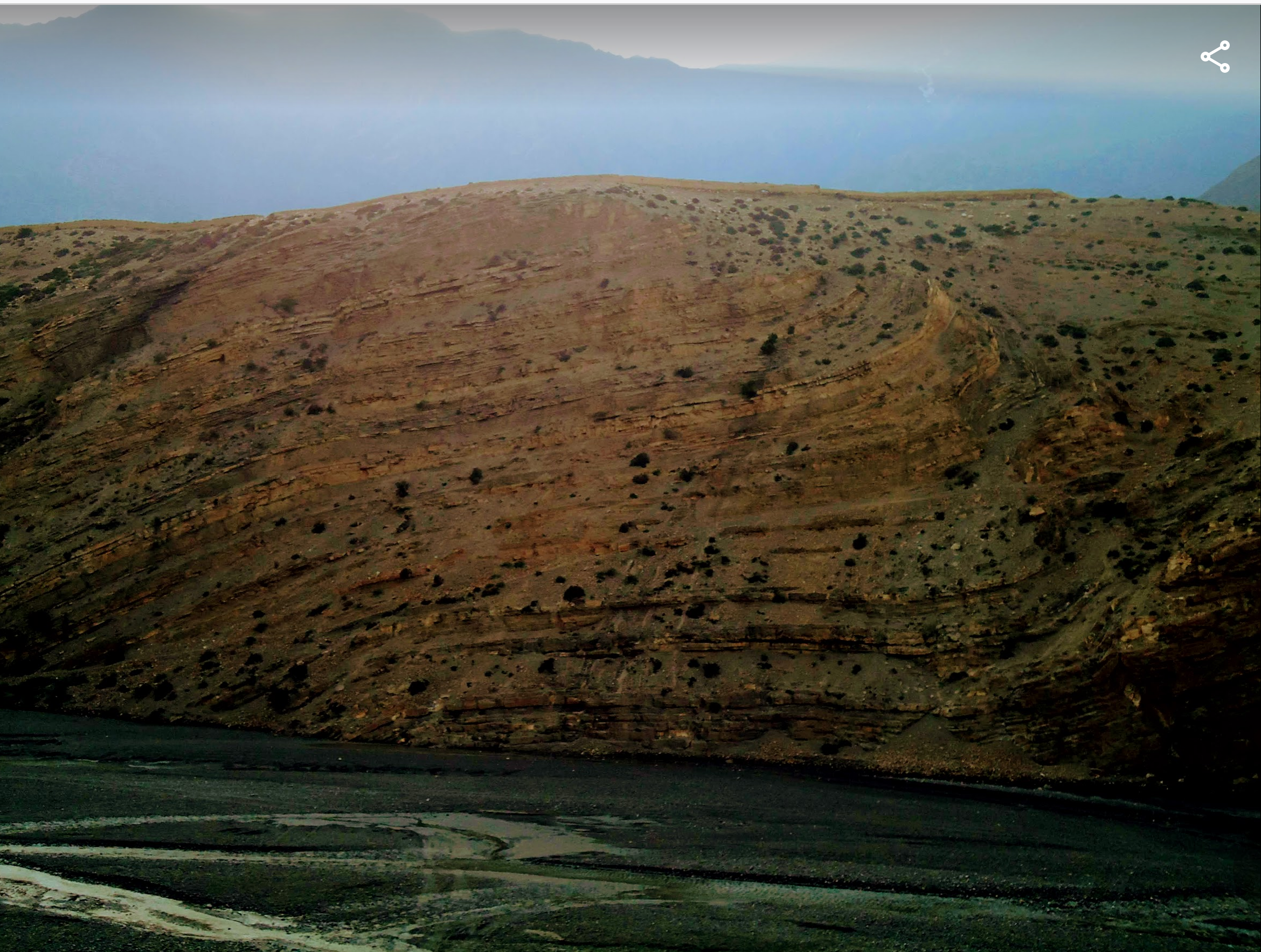 (A landscape showing the strata of the deposited materials, photo from my archieve)
I got hungry out of nowhere.
I started searching for a nearby location, where I could eat.
The roads were everywhere. It had spread out just like the branches of the tree, at its free will. Unplanned urbanization has accelerated the erosion process. It acts as the catalyst for the natural process of the erosion – changing the form and structures of the landscape.
In the chapter ‘Too Much Too Fast’, of the book ‘Tourism and Development in Mountain region’, Gurung, & Maureen, (2000) states that this isolated, culturally, and historically significant location has been severely impacted due to the unplanned development. Similarly, the study by Shrestha, A. B., & Aryal, R. (2011) supports the warming climate has resulted in rapid shrinking of glaciers in Nepal with changes in the hydrological regime, impacting agricultural productivity, livelihood in the region .
In this area of the Himalayan mountain landscape, the influence of glacier interglacier cycle, seems to have influenced remarkably. The presence of the ammonites and the existance of the caves seems to have been evolved by the natural process of sedimentation and erosion.
In one of the papers in 2015 Fort, M., has tried to untangle the natural hazards versus anthropogenic climate change and states that dramatic headward erosion, pluses of gullying, mass wasting, landslide, flash flood and debris flow has played a significant role in amplyfying the erosion after each deglaciation period. It has remarkabely changed the landscape.
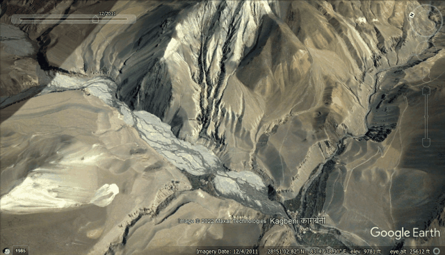
(Following gif generated from the Google Earth image of 2011 and 2022 shows the change of the landscape in the same location. From this image we can see the change in the river bank and the erosion process influencing the mountains.)
While observing this unique topography, I felt that the natural process defines the landscape. Recent activities of humans have influenced the natural process to some extent. But if there is war between anthropogenic and natural process, in this location, Natural process will win the competition. Natural processes are the key to change. Anthropogenic activities have attempted to play with the key, but humans still don’t know how does the natural key functions.
Bardan et in 2002, has done an interesting study on how much India has drifted during the Late Cretaceous using ammonites as index fossils – dating the relative age of rocks in which the fossils appear. Similarly, Bisht et al in 2015 has done an intersting study using optical and radiocarbon dating to reconstruct the history of late Quaternary glaciation and current landform evolution in Uttharakhand India.
But how much Nepal has been able to do this? My search didn’t found much.
These ammonites hold a culturlly singnificant place, and can be strong refrence for the study of origin of these landscape.
I looked at the watch. It was late afternoon.
I still don’t know whether I will be able to fly back tomorrow. Shall I hire the local bus? The road to this place is treacherous. I had watched the top gear Nepal episode where they had driven to this place. It was beautifully rough experience for the driver.
 (Keeping this landscape photo from my archieve to show the other side of the mountain)
This was the religious trip; may be next time I should do the scientific expedition trip. I should bring friends who have knowledge about archeology and climatology.
Let me think!! who has this knowledge !!
May be next year I should bring my wife and both of my children.
But
Will they be able to understand the concept of the God !!
The beauty and science behind this location !!
I am myself having difficulty understanding science, how could they?
But will my grand grandchildren be able to see these marvelous stone piece?
Will they be as happy as my mother was !!
Will this place and these ammonites continue to be as sacred as they are now !!
A message popped up in my phone.
Is it from Dr. Amrit !! He might know more details about this !!
The message read: Where are you? A plane is coming tomorrow. Shall I book a ticket for you?
I was happily attempting to respond to his text.
And
My phone’s battery ran out, and it turned off. I looked around. The sun was setting in the west. There was no house, no human, no creature. In the midst of the enormous mountains, I was a tiny creature. There was absolute silence; all I could hear was the sound of the wind.
Refrences used in the text:
- Alt, K. W., Burger, J., Simons, A., Schön, W., Grupe, G., Hummel, S., … & von den Driesch, A. (2003). Climbing into the past—first Himalayan mummies discovered in Nepal. Journal of Archaeological Science, 30(11), 1529-1535.
- Bardhan, S., Gangopadhyay, T. K., & Mandal, U. (2002). How far did India drift during the Late Cretaceous?—Placenticeras kaffrarium Etheridge, 1904 (Ammonoidea) used as a measuring tape. Sedimentary geology, 147(1-2), 193-217.
- Bisht, P., Ali, S. N., Shukla, A. D., Negi, S., Sundriyal, Y. P., Yadava, M. G., & Juyal, N. (2015). Chronology of late Quaternary glaciation and landform evolution in the upper Dhauliganga valley,(Trans Himalaya), Uttarakhand, India. Quaternary Science Reviews, 129, 147-162.
- Blum, M. D. (2007). Glacial-interglacial scale fluvial responses. Archives 995–1010.
- Dhital, M. R. (2015). Geology of the Nepal Himalaya: regional perspective of the classic collided orogen. Springer.
- Duncan, C. C., Klein, A. J., Masek, J. G., & Isacks, B. L. (1998). Comparison of Late Pleistocene and modern glacier extents in central Nepal based on digital elevation data and satellite imagery. Quaternary Research, 49(3), 241-254.
- Fort, M. (2015). Natural hazards versus climate change and their potential impacts in the dry, northern Himalayas: focus on the upper Kali Gandaki (Mustang District, Nepal). Environmental Earth Sciences, 73(2), 801-814.
- Fort, M., & Cossart, E. (2013). Erosion assessment in the middle Kali Gandaki (Nepal): A sediment budget approach. Journal of Nepal Geological Society, 46, 25-40.
- Ghimire, M., Poudel, R. C., Bhattarai, N., & Luintel, M. C. (2011). Wind energy resource assessment and feasibility study of wind farm in Mustang. Journal of the Institute of Engineering, 8(1-2), 93-104.
- Gurung, C. P., & Maureen, A. (2000). from Nepal’s Lost Kingdom of Mustang. Tourism and development in mountain regions, 239.
- Haffner, W., & Pohle, P. (1993). Settlement Processes and the Formation of States in the High Himalayas Characterized by Tibetan Culture and Tradition. Ancient Nepal. Journal of the Department of Archaeology, 134, 42-56.
- Heimsath, A. M., & McGlynn, R. (2008). Quantifying periglacial erosion in the Nepal high Himalaya. Geomorphology, 97(1-2), 5-23.
- Messerschmidt, D. A. (1983). Geography and sacred symbolism of Muktinath Shrine, Nepal. Himalayan Review, 15, 39-57.
- Messerschmidt, D. A., & Sharma, J. (1981). Hindu pilgrimage in the Nepal Himalayas. Current Anthropology, 22(5), 571-572.
- Monecke, K., Winsemann, J., & Hanisch, J. (2001). Climatic response of Quaternary alluvial deposits in the upper Kali Gandaki valley (West Nepal). Global and Planetary Change, 28(1-4), 293-302.
- Owen, L. A., Derbyshire, E., & Fort, M. (1998). The Quaternary glacial history of the Himalaya. Journal of Quaternary Science, 13(6), 91-120.
- Shrestha, A. B., & Aryal, R. (2011). Climate change in Nepal and its impact on Himalayan glaciers. Regional environmental change, 11(1), 65-77.
- Simons, A., & Schön, W. (1998). Cave systems and terrace settlements in Mustang, Nepal: Settlement periods from prehistoric times up to the present day. Beitr Allgem Vergleich Archäol, 18, 27-47.
Note: I submtited this as a class assignment
This blog appears in the category: